The Climate Atlas for the region of Stuttgart was published in 2008, based on the previous work in this area carried out by the City of Stuttgart since the 1980s and by the in-house urban climatology department (existing in the City of Stuttgart since 1938). As part of a research project on "Integrative urban-regional adaptation strategies" run by the Federal Ministry of Education and Research (BMBF), the climate atlas is currently being updated and its contents are being further developed into an urban-regional online information and advice tool.
The Climate Atlas provides standardised climatic assessments for the towns and municipalities of the Stuttgart region. The Atlas comprises maps which show regional wind patterns, flows of cold air, air pollution concentrations, and other relevant information required to inform planners on how to improve climatic conditions that could inform new projects and retrofits. The Atlas classifies urban areas on the basis of the role they play in air exchange and cool airflow in the Stuttgart region as well as their topography, development density and character, and provision of green space. The Atlas distinguishes eight categories of areas in this manner, and for each of them different planning measures and recommendations are provided.
In addition to responding to local climate characteristics, the following principles form the basis for the planning recommendations included in the “Climate Booklet for Urban Development Online – Städtebauliche Klimafibel Online”:
- Vegetation should be placed to surround developments and larger, connected green spaces should be created or maintained throughout developed areas to facilitate air exchange;
- Valleys serve as air delivery corridors and should not be developed;
- Hillsides should remain undeveloped, especially when development exists in valleys, since intensive cold- and fresh-air transport occurs here;
- Saddle-like topographies serve as air induction corridors and should not be developed;
- Urban sprawl is to be avoided;
- All trees growing in the urban core with a trunk circumference of more than 80 cm at height of 1m are protected with a tree preservation order.
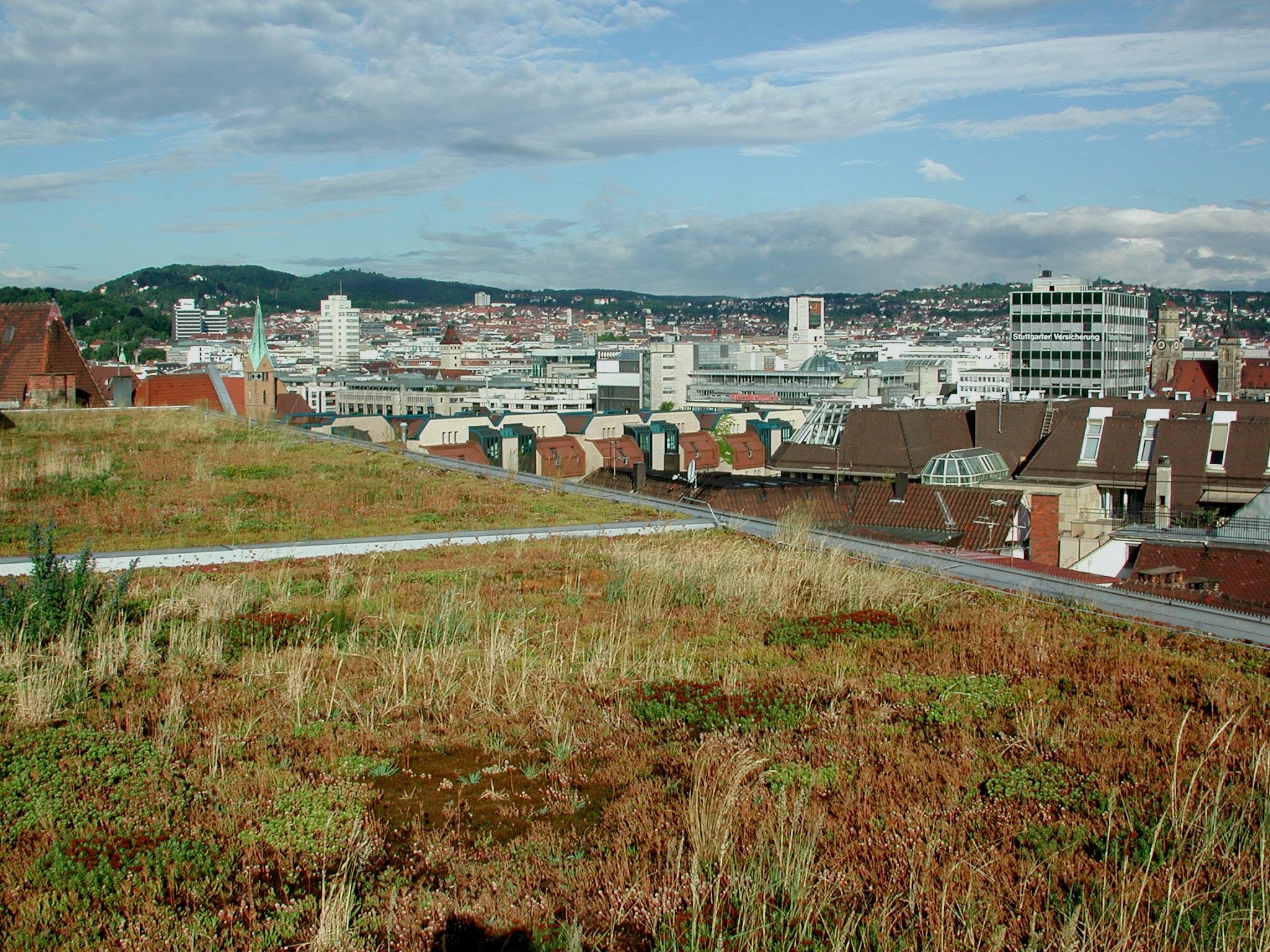
The implementation of the recommendations in the Climate Atlas and in the Climate Booklet is carried out by the Office for Urban Planning and Urban Renewal, supported by the Office for Environmental Protection. The Section of Urban Climatology within the Office for Environmental Protection evaluates the climatic implications of intended development and larger buildings. As a result of the implementation of these recommendations, over 39% of Stuttgart’s surface area has been protected to preserve natural elements. In addition, greenery covers more than 60% of the city. Stuttgart contains 5,000 hectares of forests and woodland, 65,000 trees in parks and open spaces and 35,000 street trees. More than 300,000 square meters of rooftops have been greened and 63 out of 273 (as of 2019) kilometres of tram tracks have been planted with oligotrophic grasses. Moreover, in line with the city development vision, 60 hectares of greenfield land previously earmarked for development has been cut from the 2010 land development plan to protect existing green space. Targeted interventions such as a building ban in the hills around the town, and prevention of building projects that might obstruct the ventilation effect of nocturnal cold-air flows have resulted in preservation and enhancement of air exchange and cool air flows in the city.
To further improve the adaptation capacity of Stuttgart to hotter summers, the green infrastructure in the city is currently being expanded as part of a climate protection package, including: greening of buildings, shading of traffic routes (e.g. footpaths and bike-routes), shading of facades of buildings through street trees, and the upgrading of smaller public areas to "cool spots" (areas equipped with drinking water, water fountains, water sprays and shading facilities). Moreover, the city is implementing a program aiming to improve urban blue infrastructure, in particular through drinking fountains and other water elements. Water surfaces and moving water contribute to a reduction in thermal loads through evaporation. The project "Integrated strategies for strengthening urban blue-green infrastructures" (INTERESS-I) has implemented a pilot to test climate-effective and resilient building blocks of blue-green infrastructure. The overarching goal is to develop an integrated strategy for optimizing green, water, settlement and building structures, on the basis of water availability and water quality and taking into account climate resilience, social justice and quality of life needs.


