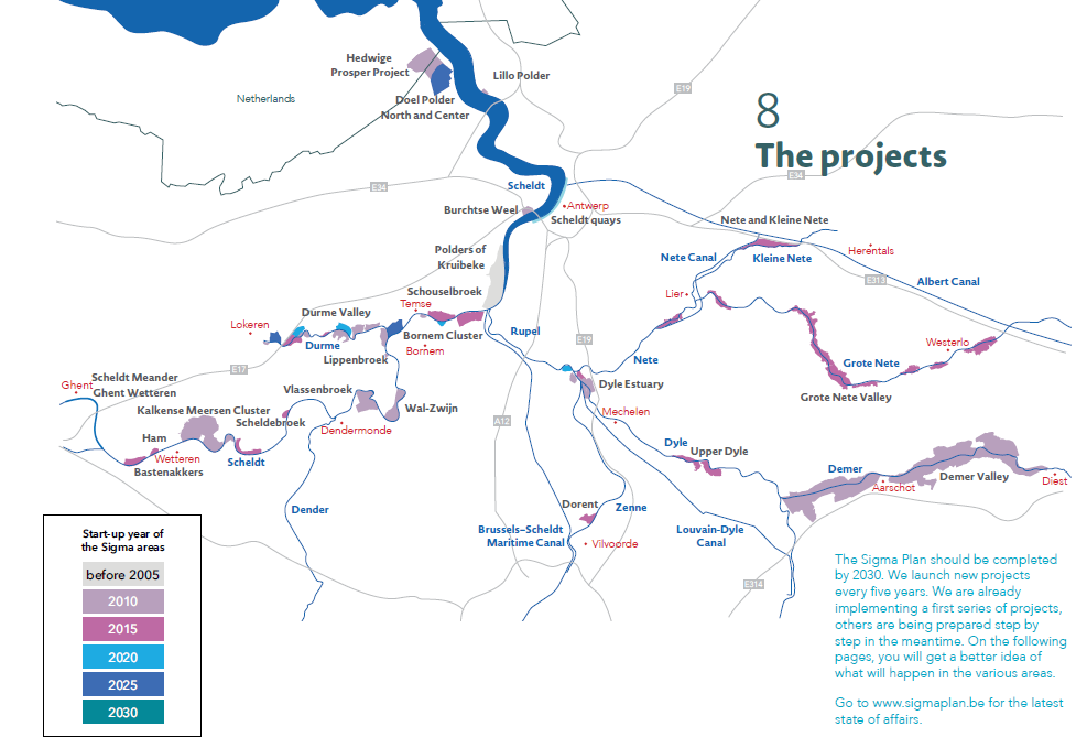
While the Sigma Plan’s main purpose is flood control, the plan is based on an integrative perspective on river management which acknowledges various river functions and their importance for society. These include: shipping, nature protection, preservation of landscape values, cleansing functions, fish nurseries and more. The Sigma Plan was originally conceived in 1977 with flood control as its main purpose. Since then, perspectives on water management have evolved. An updated Sigma Plan was adopted in 2005. It was based on three main pillars; flood protection, access to Scheldt Ports and a natural functioning of the physical and ecological system.
The original Sigma Plan called for dikes stretching a total length of 512 kilometres to be raised and strengthened, the establishment of 13 controlled flood areas covering a total of about 1,100 hectares, as well as the construction of a storm surge barrier. Plans for the storm surge barrier were later suspended after analysis showed that the benefits did not outweigh the costs. The consideration that the storm surge barrier was prohibitively expensive, together with an increased demand for a healthier river ecosystem, led to a greater application of a concept called ‘room for the river’. The 2005 revision also took into account projected climate change impacts.
The 2005 plan gives a greater role to controlled flood areas (CFAs) and depoldered areas that counter storm surges by temporarily storing excess water. Controlled flooding areas have low dikes, called overflow dykes, along the river, and higher dykes on the inland side to maintain flood protection. The overflow dykes allow water to flood during storm surges. After high water levels have receded, drainage outlets allow water to exit. The CFAs help attenuate the impacts of flooding events by increasing the river catchment area, thus reducing upstream water levels. The volume of many CFAs is increased as their ground levels are below the average water level due to historic compacting of the soil and loss of natural sedimentation processes. These low ground levels however mean that overflow dikes and artificial water regulation are needed. The predominant use for land within CFAs has been as nature areas that contribute to achieving conservation objectives and improving water quality. Under EU nature legislation – in particular, requirements to compensate for the loss of natural areas taken by the expansion of the Port of Antwerp – the total area set aside as flooding areas was increased for the purpose of nature development: by 2030, a total of about 2,450 hectares are to be created. Another 650 hectares have been indicated as possible future flood zones to be constructed after 2030 if necessary to guarantee flood safety beyond 2050.
Some CFAs also include controlled tidal areas, where a regular, reduced tide is produced through an adjustable weir system in the overflow dike. During high tide, water from the Scheldt flows into the area through a weir and during low tide it flows out through a low weir. The controlled tidal areas allow for the creation of tidal habitats while maintaining the CFA’s functions.
Depoldering areas are zones where dike protection is moved inland exposing a former polder (land reclaimed from the water) once again to tidal influences. Depoldered areas provide room for river water during high water levels. Thus they, like the CFAs, attenuate storm surge levels. They also provide room for estuarine habitats.
The Sigma Plan also includes projects aiming to raise and reinforce river levees for a total length of 645 km. The required thickness and height of the Scheldt river levees have been calculated considering the water pressure on the levees, through simulations of storm tides with computer models. Levees are raised to 8 metres TAW (Tweede Algemene Waterpassing, the reference height for measuring water levels in Belgium) in those areas that are more upstream along the River Scheldt. Levees are raised to 11 metres TAW in the section between Antwerp and the Western Scheldt.
The Sigma Plan has already proven its effectiveness in recent years during several storms surges occurred between 2013 and 2018, successfully containing excess water and preventing dangerous flooding. In particular, during the event of the 3rd January 2018, a strong storm tide caused very high water levels in the Scheldt and its tributaries. Fifteen Flood Control Areas, out of the total sixteen already completed, became operational, buffering the excess water.


