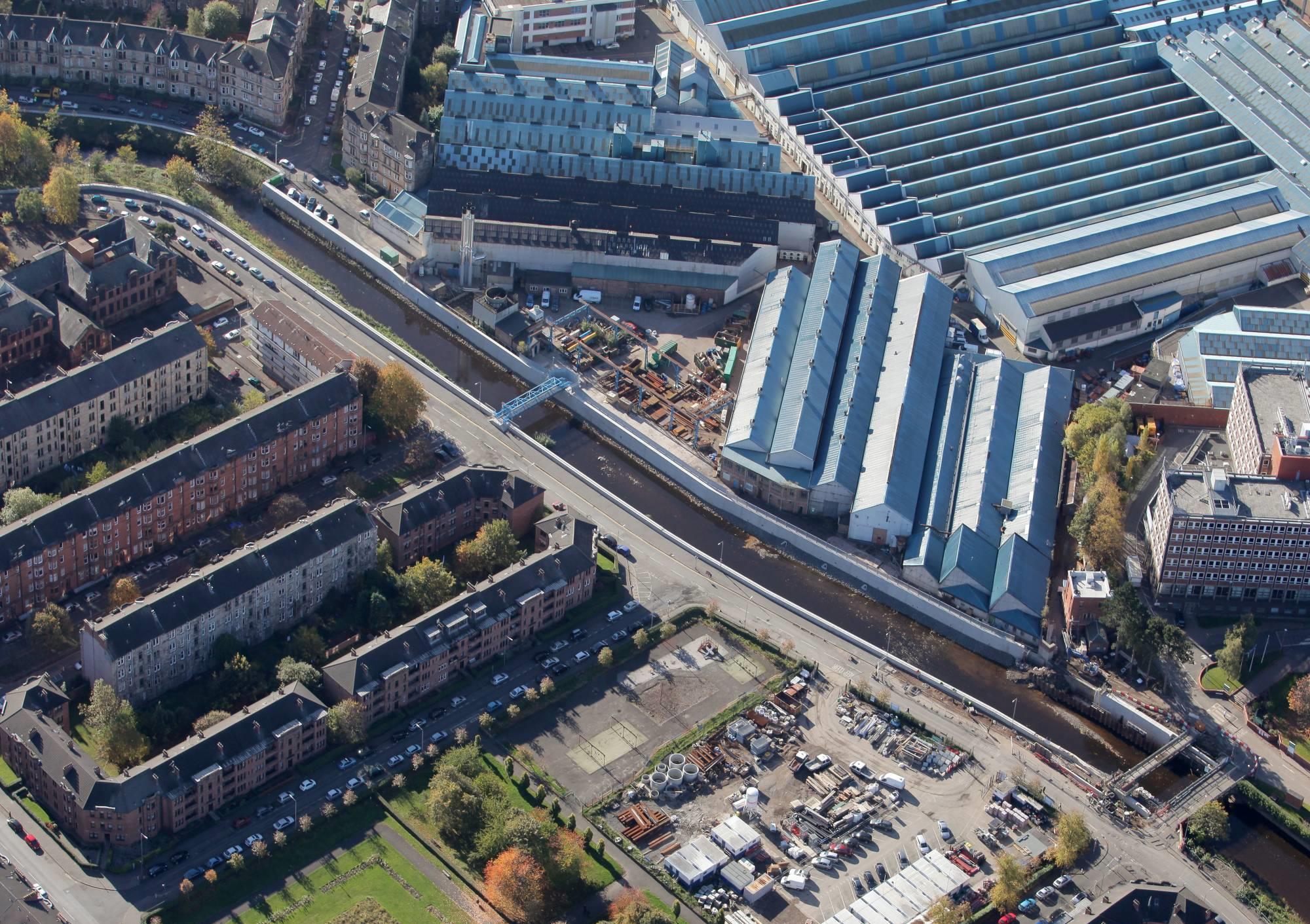
A number of studies were carried out since 1984 to determine a suitable flood prevention scheme for the White Cart Water and its tributary to provide protection up to the 1 in 200 year event (corresponding to protection up to 1 in 100 years event by 2050s, according to considered climate change projections). In 2002 the development of the scheme began with the help of consulting engineers. The resulting White Cart Water Flood Prevention scheme, the largest flood protection scheme in Scotland, was published in November 2004 and approved by the Scottish Government in 2006.
The scheme is based on the catchment management principle. It combines cutting-edge engineering solutions and natural flood risk management techniques. Central to this is the optimisation of flood water storage in the upper catchment, allowing flood defence walls within the city to be limited to an acceptable height, helping to limit the impact on existing wildlife habitats and avoid creating barriers between the river and the community. The alternative approach would be a 'walls only' solution, which would have resulted in the construction of unacceptably high walls along the urban corridor of the river.
The plan involved the construction of three flood storage areas upstream the city to temporarily hold back the bulk of floodwater generated by extreme rainfall, and control the release of water passing downstream through the city to an acceptable level. In all, 33 sites were considered for the construction of the storage reservoirs with dams up to sixteen metres in height; these sites were evaluated for size, topography, geotechnical suitability and the associated environmental impacts. Several of the sites considered were discarded due to significant environmental and geotechnical concerns. Together the three finally constructed flood storage areas have the capability to hold back over 2.6 million cubic metres of flood water and reduce peak river flows by up to 45%.
Central to the successful operation of the storage areas was the installation of the world’s largest Hydro-Brake flow control devices into the three dams at each storage area. The Hydro-Brake is designed to enable water to flow unrestricted through it for as long as possible. When the water upstream reaches a pre-determined height in a flood situation, the Hydro-Brake activates and releases water into the river at a controlled rate. The storage sites remain dry for most of the year.
During the storm, the temporary storage areas significantly reduce the flow downstream. Nevertheless, this much-reduced flow, combined with the large catchment area downstream of the flood storage areas still pose a threat and be capable of causing flooding in Glasgow. For this reason, flood defences, in the form of low walls and embankments, were also constructed in selected parts of the river corridor through the city of the total length of 7.6km.
These works also gave opportunities for environmental enhancement along the river corridor and around the storage sites. The central concrete culverts, which contain the Hydro-Brakes, were encapsulated by large earth dams, which were constructed mainly using site-won material, which significantly limited the need for heavy lorry journeys to transport 180,000 cubic metres of material. Rather than leave the concrete structures of the spillways for these reservoirs exposed, as they are unlikely to be used, they were in-filled with sacrificial material (soil). Grass cover was established to ensure the dams blend with the existing landscape. These spillways would only be deployed if 1:200 year flooding event happened, in which case the force of released water would flush it out.
The dams and culverts have been designed to ensure they do not prevent the movement of fish and mammals upstream and downstream. The base of the culverts incorporates baffles and boulders to ensure a varied flow pattern and to retain a minimum depth of water for fish passage in low flows. In addition, there are no hydraulic drops, with the base of the culvert laid at the same gradient as the original river bed. Mammal ledges have also been provided throughout the length of the culvert and ongoing monitoring has shown these are being used by otters at all three sites. Moreover, the flood storage areas were seen as an opportunity to enhance biodiversity through the creation of artificial wildlife habitats: woodland with 6,000 newly planted trees, scrub, and over 90,000 square metres of species-rich wet grasslands, shallow scrapes and ponds. Similarly, within the city re-development of an existing park, embellishment of gardens and allotments was undertaken. Also, artificial habitats for birds, bats and otters were created and 1,000 trees were planted. The developments likewise contributed to the improvement of green recreational spaces.


